Contour modeling is a critical component of site analysis and planning. It involves the representation of the natural topography and terrain features of a project site, enabling informed decision-making for sustainable and efficient development. The modeling process provides a foundation for site design, grading, drainage, and construction planning.
GIS (Geographic Information Systems) for spatial analysis.
CAD (Computer-Aided Design) tools for precise modeling and design.
Drones and LiDAR for accurate topographical surveys.
Renewable energy systems like solar panels positioned on south-facing slopes.
Minimizing deforestation and land alteration during construction
o Contour modeling defines elevation points at regular intervals across the project site.
o It identifies high and low points, slopes, ridges, valleys, and other significant features.
o Key for determining buildable areas and ensuring safety in construction.
o Steep slopes (>45°) are generally avoided for development, as per norms.
o Contour maps guide the placement of drainage systems, retaining natural water flows.
o Water-sensitive areas and potential erosion zones are identified for mitigation.
Roads align with contour gradients to minimize excavation and land disturbance.
Pathways in hilly areas require grading that adheres to acceptable slopes
Structures are positioned considering natural contours to reduce cutting and filling.
o Orientation maximizes environmental benefits like wind flow and solar access.
Green spaces and vegetation are planned in harmony with the site's natural topography.
Retaining walls and terracing are used to stabilize slopes where necessary.
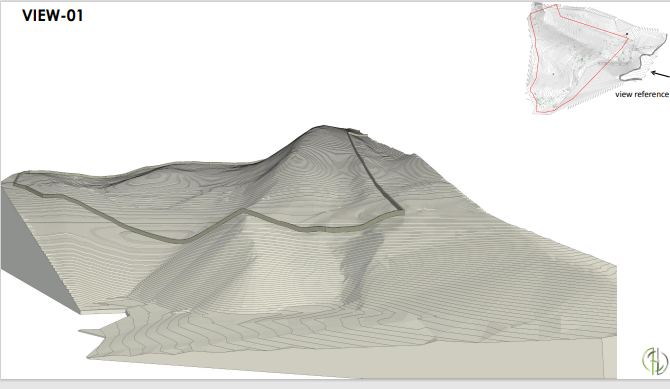
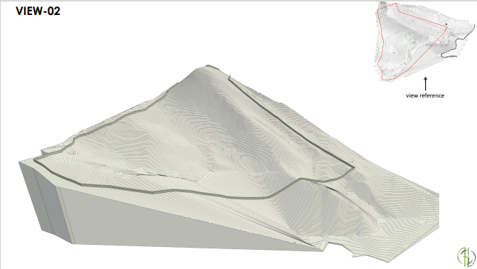
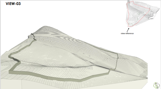
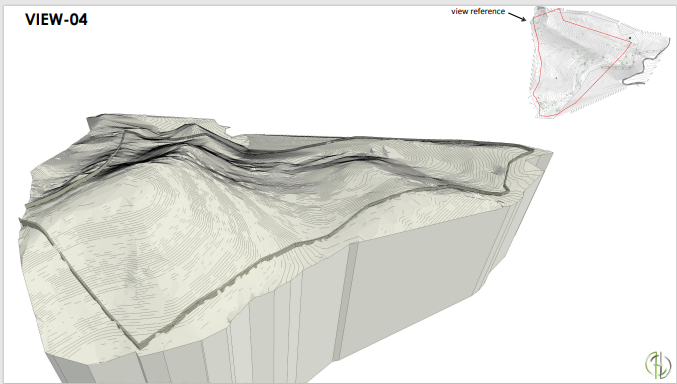
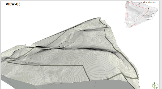
The uploaded files (VIEW-01 to VIEW-05) likely represent visual perspectives of the site. These views could include:
Panoramic perspectives for visualizing elevation changes.
Cross-sectional details illustrating terrain profiles.
3D renderings showcasing proposed designs integrated with the existing topography.
Effective contour modeling enhances the aesthetic, functional, and environmental aspects of a project. By leveraging detailed views, slope analyses, and modern technologies, projects can achieve a balance between development and sustainability.
Hillstones is more than just a residential development—
It is a forward-thinking community that redefines modern living in harmony with nature.